Kotugodella Fort: The Forgotten Portuguese Outpost Beneath the Tea Country of Old Ceylon
Kotugodella Fort Sri Lanka | Long before the railway climbed through Idalgashinna and the hills of Ceylon were covered in tea, these mountains witnessed a very different chapter of history. Hidden among the remnants of an older landscape is the story of Kotugodella Fort, a Portuguese military outpost associated with one of the most disastrous campaigns in colonial Ceylon.
A Forgotten Fort in the Hills of Uva
There is a particular kind of history that disappears in the hill country of Sri Lanka. It is not always found in grand buildings, ancient temples or monuments with carefully maintained gardens. Sometimes it survives as a few stones on a hillside, partly concealed by grass and undergrowth, while everyday life continues around it. Kotugodella Fort belongs to that quieter history.
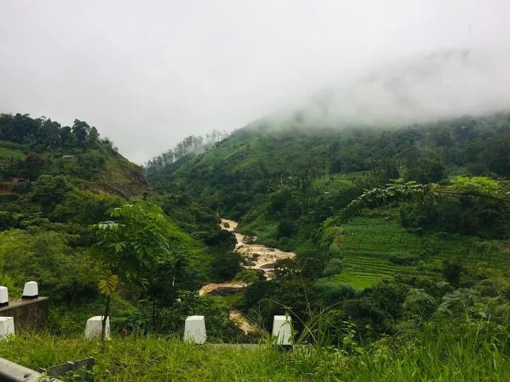
The name is unfamiliar to many who travel through the highlands of Uva. Idalgashinna, Haldummulla and the surrounding tea country are better known for misty mountains, old railway stations, winding roads and the memories of British Ceylon. Yet this landscape had a turbulent past long before the first tea bushes were planted. More than a century before the British established themselves in the island, Portuguese soldiers were attempting to make their way through these mountains towards the Kingdom of Kandy.
Kotugodella was associated with that struggle. Although little remains of the fort today, its history takes us back to a time when the hills were not considered beautiful scenery but difficult military territory. The mountain passes that now attract travellers once formed part of the defences of an independent kingdom resisting European expansion.
Before the Tea Estates, There Was a Frontier
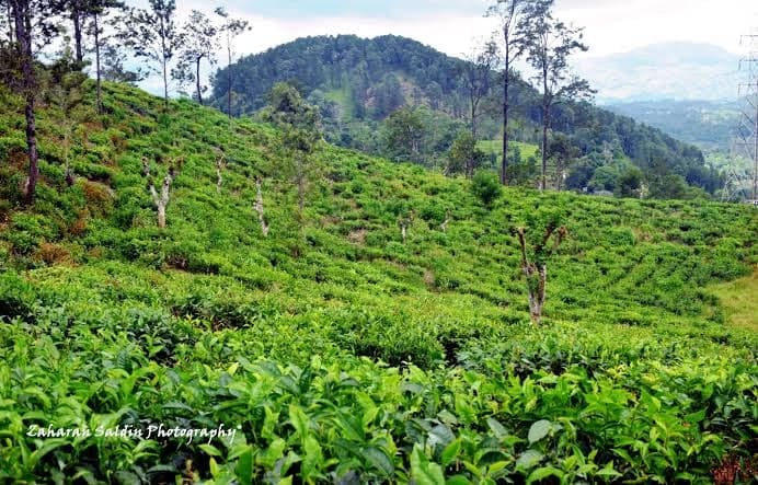
It is difficult to imagine the hill country without its tea plantations. The neat rows of bushes, estate roads, workers’ settlements and old plantation buildings have become such familiar features that they almost seem to have always belonged to the mountains. But the Ceylon of 1630 was an entirely different country, with a political and geographical landscape shaped by competing kingdoms and European colonial ambitions.
The Portuguese controlled important coastal territories, but the interior remained fiercely contested. The Kandyan kingdom continued to resist attempts to bring the island under Portuguese authority, and the mountains provided natural protection. Narrow passes, steep slopes and difficult approaches made military expeditions dangerous, particularly for armies unfamiliar with the terrain and dependent on long supply routes.
The route through Haldummulla and Idalgashinna was among the approaches into Uva. These hills were not merely scenery. They formed part of the geographical defence of the Kandyan kingdom, where an advancing army had to consider every climb, every descent and the possibility of attack from forces who understood the country. In such a landscape, even a relatively small fortification could possess an importance far greater than its size suggested.
The Portuguese March into Uva in 1630
In 1630, the Portuguese commander Constantino de Sá de Noronha led a major military expedition into the Kandyan kingdom. His objective was to extend Portuguese military power into Uva, and the campaign took his forces through difficult mountainous country associated with the Haldummulla–Idalgashinna approach. The expedition became one of the most consequential Portuguese military campaigns in the island’s history.
Kotugodella Fort is traditionally identified as a Portuguese defensive position or staging post connected with this advance. Unlike the large coastal fortresses built to defend harbours and commercial settlements, an inland military post served a more immediate purpose. It could provide a position from which soldiers watched an approach, organised movement or supported operations in hostile territory.
It is sobering to imagine the men who travelled through these mountains nearly four centuries ago. They were not looking at a romantic hill-country landscape. They were moving through unfamiliar and dangerous terrain, carrying weapons and provisions, uncertain of the resistance ahead. The beauty of the mountains offered little comfort to an army that might have to fight its way through them.
The Portuguese succeeded in advancing into Uva, but their apparent progress concealed serious danger. The forces of the Kandyan kingdom understood both the terrain and the vulnerabilities of an invading army. The expedition would end in catastrophe, leaving a lasting mark on the history of Portuguese rule in Ceylon.
The Battle of Randeniwela and the Portuguese Defeat
The events of August 1630 occupy an important place in Sri Lankan military history. After advancing into Uva and reaching Badulla, the Portuguese army found itself facing Kandyan forces operating under King Senarat and his sons, including the future King Rajasinghe II. What followed became one of the most significant defeats suffered by the Portuguese during their attempts to control the island’s interior.
On 25 August 1630, at the Battle of Randeniwela, the Portuguese suffered a devastating defeat. The defection of locally recruited soldiers serving with the Portuguese contributed to the collapse of their army, and Constantino de Sá de Noronha was killed. The battle represented a major victory for the Kandyan kingdom and a severe setback for Portuguese ambitions in the central highlands.
Kotugodella’s connection with the expedition gives its surviving remains particular historical interest. The fort was not itself the battlefield of Randeniwela, nor is there enough evidence to reconstruct precisely what happened within its walls. Its significance lies in its association with the campaign and the contested routes into Uva.
What may now appear to be an insignificant collection of stones once belonged to a landscape in which control of a mountain pass could influence the fate of an army. The ruins remind us that geography played an important role in the struggle between the Portuguese and the Kandyan kingdom. These were mountains where the ability to move, retreat, defend and resupply could determine the outcome of a military expedition.
When the British Changed the Landscape
The passing of time brought an extraordinary transformation. The Portuguese era ended, Dutch power followed along the coast, and eventually the British came to control the island. During the nineteenth century, the hill country underwent changes that would have seemed unimaginable to soldiers travelling through it in 1630.
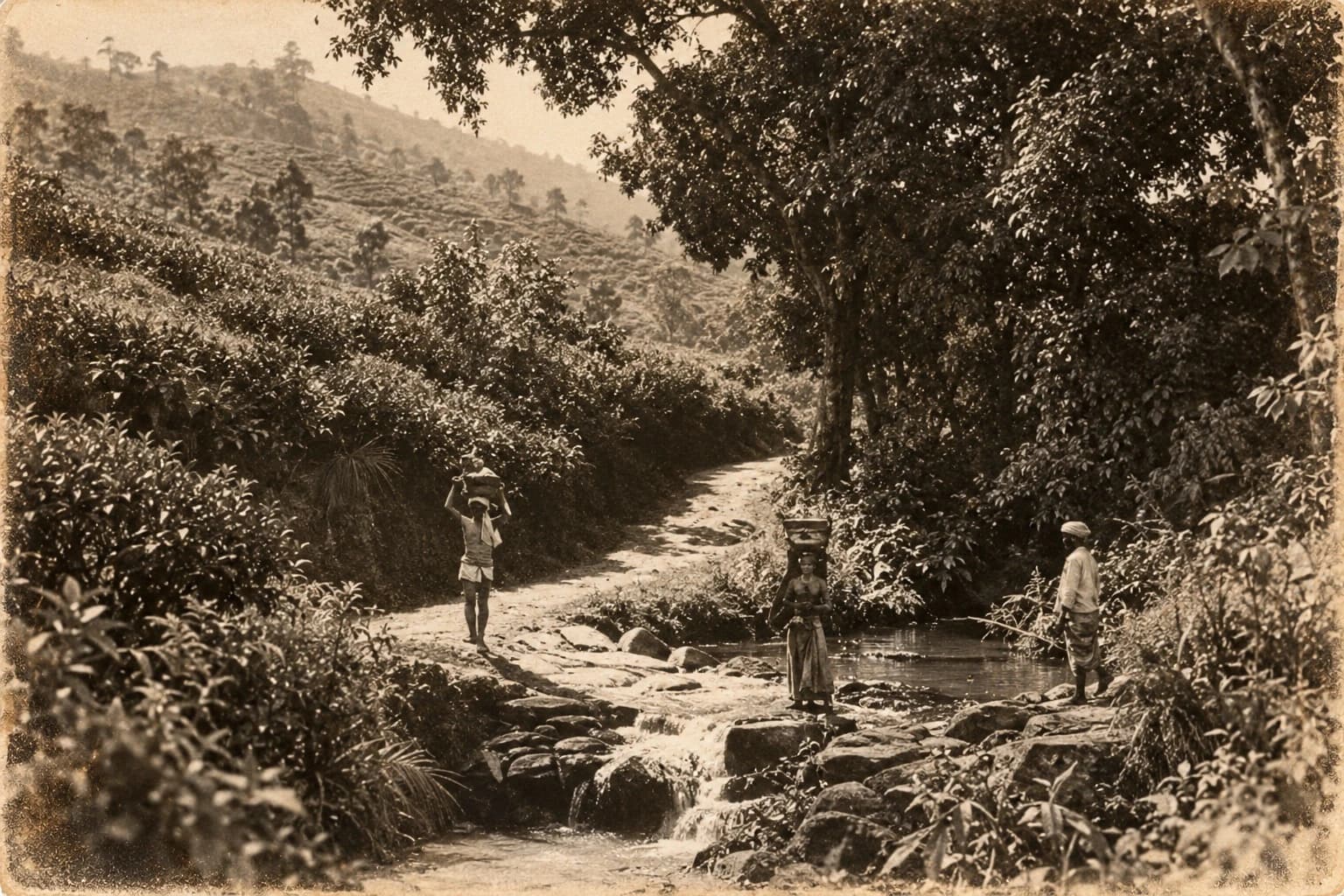
Forests were cleared for commercial plantations. Coffee cultivation expanded before disease devastated much of that industry, and tea subsequently transformed the uplands. Estate roads were cut into hillsides, bungalows and factories appeared, and workers’ settlements became permanent features of the landscape. The railway pushed deeper into the mountains, bringing an entirely new rhythm to districts once reached through difficult tracks and mountain passes.
Idalgashinna eventually became known for its railway station and remarkable mountain scenery. The same highland region once associated with difficult military passage became part of the plantation economy of British Ceylon. The mountains had not moved, but almost everything taking place around them had changed.
One can imagine the contrast across the centuries. Portuguese troops struggled through mountain approaches in the seventeenth century, while generations later railway passengers looked out across valleys as trains climbed towards the tea-growing districts. The purposes, sounds and people of the landscape had changed completely. The old military routes had become part of a country connected by railways, estates and commercial roads.
The Fort That Almost Disappeared
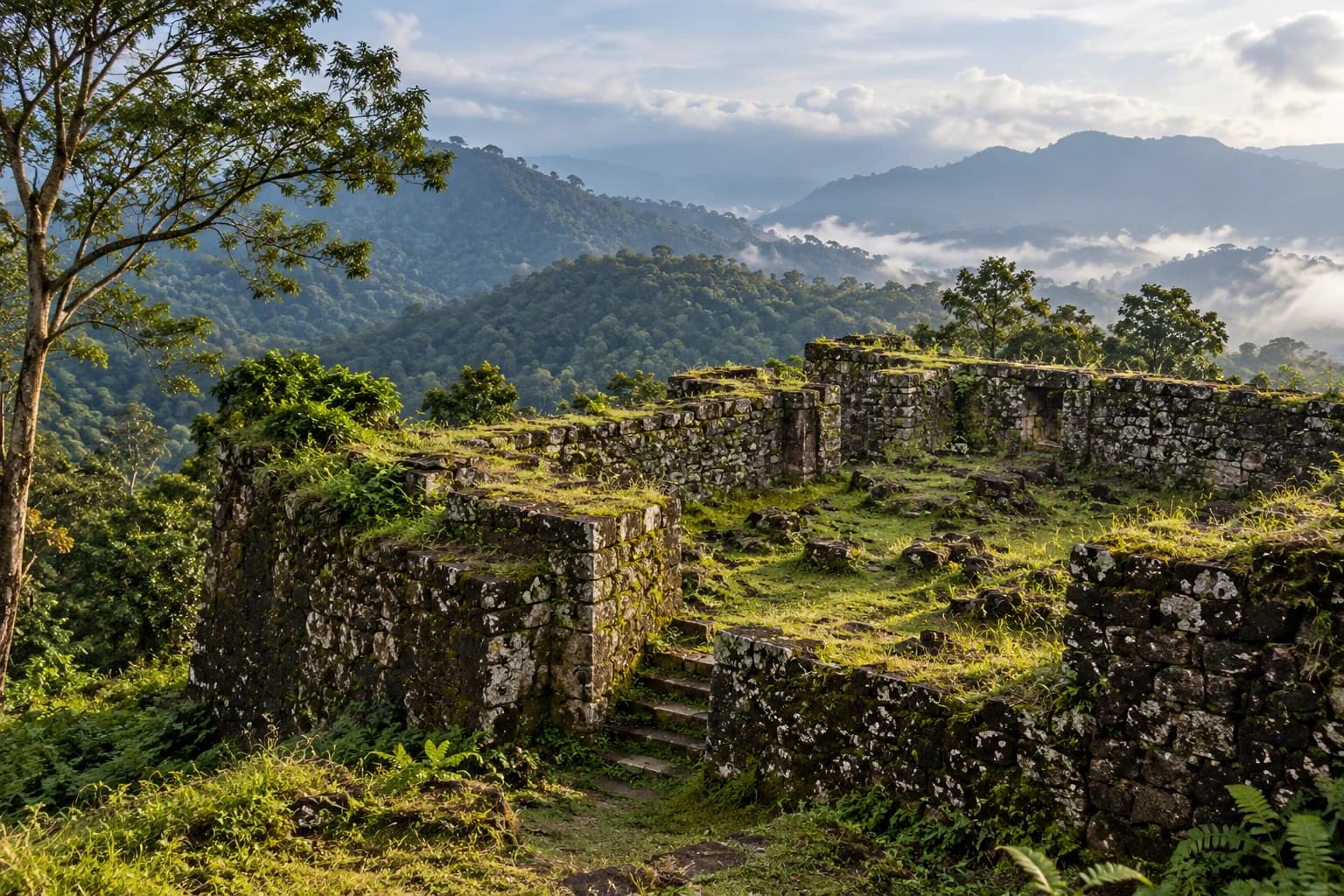
Today, Kotugodella is a ruin rather than a recognisable standing fortress. Descriptions of the remains refer to stone foundations and traces of defensive structures, rather than intact walls or imposing towers comparable to the great coastal forts of Galle or Jaffna. Its physical remains are modest, and a traveller unfamiliar with the history might easily overlook them.
The site was given formal archaeological protection through a government gazette notification dated 22 November 2002. That recognition is important because it identifies Kotugodella as part of the island’s historical landscape, even though the surviving structures may not attract the attention given to larger and better-known monuments.
Its obscurity is understandable. Visitors to the hill country are usually drawn towards scenic viewpoints, waterfalls, railway journeys and old plantation towns. A few ruined foundations are unlikely to compete with the views from Idalgashinna or the celebrated railway scenery of the surrounding mountains.
Yet these fragments belong to an older layer of Ceylon’s past, one that existed before the picturesque hill-country world preserved in colonial photographs and postcards. They also remind us that the history of the island cannot always be divided neatly into separate Portuguese, Dutch and British chapters. The same roads, hills and settlements repeatedly acquired new meanings under different rulers.
From Military Routes to Plantation Roads
One of the more interesting aspects of places such as Kotugodella is the way the surrounding landscape continued to serve different purposes over time. A mountain approach that mattered to seventeenth-century soldiers could later become important to traders, travellers, estate workers and plantation transport. Roads and tracks were altered, improved or abandoned as the needs of the country changed.
During the British plantation period, the hill country developed an extensive network of estate roads connecting fields, factories, bungalows and settlements with the principal routes through the mountains. The railway created another layer of movement, carrying people and goods across country that earlier generations had crossed with considerable difficulty.
The landscape around Haldummulla and Idalgashinna therefore contains histories belonging to very different periods. There is the military history of the Kandyan frontier, the commercial history of plantation agriculture and the transport history of the railway. These layers are not always obvious to someone travelling through the area today, but they help explain why the same mountain country has remained important for centuries.
Kotugodella belongs to the earliest of these stories. Its surviving stones recall a period when access through the mountains was a question of military strategy rather than railway engineering or the movement of tea.
The Old Ceylon We Rarely Remember
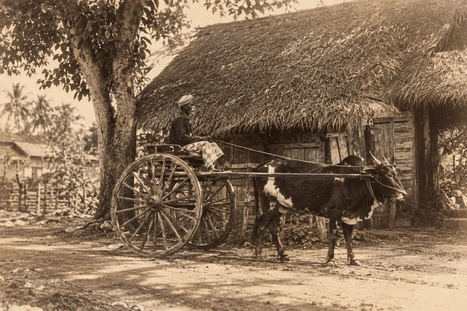
Nostalgia for Old Ceylon often begins with familiar images. There are black-and-white photographs of railway stations, tea factories standing among the hills, horse-drawn carriages, colonial bungalows and quiet streets shaded by old trees. These photographs are valuable because they allow us to see a world that has changed, sometimes beyond recognition.
But the history of Ceylon extends much further back than the period recorded by the colonial camera. Before the railway and the tea estates, there were mountain tracks, military expeditions, frontier settlements and communities whose lives were shaped by struggles for control of the interior. The country was already old when the first plantation photographs were taken.
The Portuguese who marched towards Uva in 1630 could never have imagined that the surrounding hills would one day become part of one of the world’s most recognisable tea-growing landscapes. Nor would the British planters who arrived centuries later necessarily have understood the full history beneath the land they cultivated.
Today, a traveller may pass through the hill country admiring its extraordinary beauty without realising how many different histories are gathered within those mountains. Kotugodella is worth remembering precisely because it draws attention to a chapter that has become almost invisible beneath the better-known scenery of the tea country.
Why Kotugodella Fort Matters Today
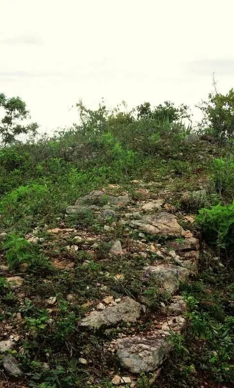
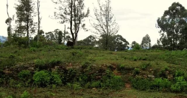
Kotugodella does not possess the grandeur of a famous coastal fortress. There are no long ramparts overlooking a harbour, no enormous gateways and no carefully arranged courtyards through which visitors can walk. The interest of the site lies in the fragments that remain and the historical questions they raise.
Its association with the Portuguese campaign of 1630 places it within a much larger struggle for control of Ceylon’s interior. The ruins also illustrate the importance of mountain geography in that struggle. Passes, ridges and approaches that may look unremarkable on a modern road map once influenced the movement of armies and the defence of kingdoms.
There is also a reason to treat the site carefully. The precise layout, construction history and operational role of the fort have not been fully reconstructed from the evidence presented here. Its traditional association with the Portuguese advance is significant, but the surviving structures should not be made to tell more than the available records support.
Preserving such places means preserving the opportunity to understand them better. An obscure ruin can still contribute to historical research, particularly when archaeological evidence is considered alongside old maps, military accounts, local place names and the geography of the surrounding mountains.
A Forgotten Story Beneath the Mist
The next time the hills around Idalgashinna disappear into the afternoon mist, it is worth remembering that their story did not begin with the railway, the tea estates or the old photographs of British Ceylon. Long before these familiar landmarks existed, the mountains guarded approaches to a kingdom that resisted repeated attempts at conquest.
The Portuguese expedition of 1630 belongs to that earlier world. It was a time when soldiers travelled through difficult mountain country, when the route into Uva carried military importance and when the outcome of a campaign could depend upon knowledge of the terrain. The Battle of Randeniwela brought that expedition to a disastrous end, but the wider landscape still contains places associated with the events of those years.
Somewhere among those hills, the remains of Kotugodella carry a small part of that history. The stones may be easy to overlook, especially in a region celebrated for its scenery, but they belong to a time when the mountains were a frontier rather than a tourist destination.
The railway arrived much later. The tea followed another history altogether. Yet beneath the familiar landscape of Old Ceylon, Kotugodella remains a reminder of the centuries that came before.
Visit us: https://trippingsrilanka.com/stories