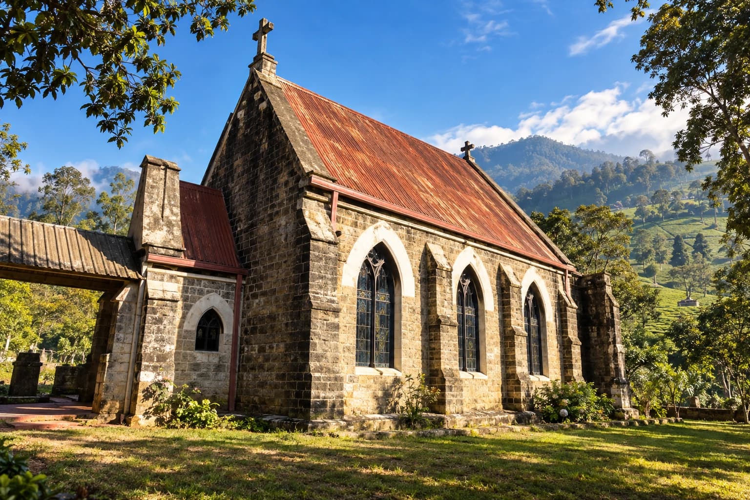
A Breakdown on the Ramboda Road: Motoring Through the Tea Country of Old Ceylon
A Roadside Moment from Old Ceylon
A vintage motorcar stands beside a winding mountain road with its bonnet raised. Two travellers wait near the vehicle while a local man appears to examine the problem. Behind them, perfectly arranged rows of tea climb towards a dark, cloud-covered mountain.
At first glance, it is simply a photograph of an inconvenient roadside breakdown. Yet the scene captures something much greater: the experience of travelling through the Central Highlands during the motoring age of Old Ceylon.
According to the caption accompanying the photograph, it was taken on the Nuwara Eliya–Ramboda road, during the climb past Weddemulle Estate and before reaching Labookellie. This places the scene along one of Sri Lanka’s most historic and visually dramatic hill-country routes.
The identities of the people, the photographer and the precise date remain unconfirmed. However, the motorcar’s old EY registration plate offers an important clue. EY belonged to an earlier vehicle-registration system that used letter combinations associated with the name Ceylon. This system came before the introduction of the familiar “Sri” registration plates in 1956, although cars carrying older registrations naturally remained on the roads afterwards.
Check our previous article – https://trippingsrilanka.com/stories/kadugannawa-pass-gateway-to-kandy
The Mountain Road to Nuwara Eliya
The road through Ramboda was never an ordinary highway.
It formed part of the route connecting the lower hill country around Gampola and Pussellawa with the elevated plateau of Nuwara Eliya. Travellers approaching from Kandy had to climb through steep terrain, negotiate sharp bends and pass between mountain slopes cut by streams and waterfalls.
Today, this route forms part of the A5 highway between Peradeniya and Nuwara Eliya. Historical accounts describe the road as one constructed during the colonial period to carry coffee and, later, tea from the highlands towards commercial centres and the port of Colombo.
Before modern road improvements, the climb through Ramboda was slower and considerably more demanding. Engines could overheat, tyres could fail and mechanical breakdowns were not unusual.
A stopped vehicle on a remote estate road might depend on assistance from an estate employee, another motorist or a nearby workshop.
The photograph therefore records a familiar reality of early hill-country motoring. The journey was part of the adventure.
A Road Built Through Tea Country
The Ramboda road was important because it connected several worlds.
It linked the plantation districts with Nuwara Eliya, one of the most famous hill stations of Old Ceylon. It also connected estate country with towns, railway points and low-country markets.
For the tea industry, roads like this were vital. They carried estate officials, machinery, supplies, mail, workers, visitors and produce. They also allowed planters and holidaymakers to move between Kandy, Nuwara Eliya and the surrounding estates.
The road was therefore not only scenic. It was practical.
Every bend, cutting and retaining wall formed part of the infrastructure that made the hill country function.
A Roadside Moment Near Weddemulle Estate
The location described in the original caption is especially significant.
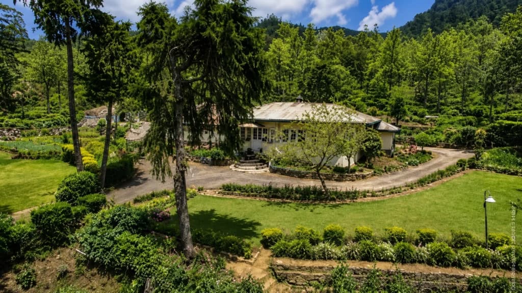
Weddemulle Estate, sometimes written as Wedamulla or Weddemulla, lies on the slopes between Ramboda and Labookellie. Historical descriptions place Labookellie above it towards Nuwara Eliya, while the older Rangbodde area lies farther down the main road towards Ramboda.
The estate landscape follows the natural contours of the mountains. Tea fields wrap around ridges, disappear into hollows and reappear on distant slopes. Roads were built across this difficult terrain to connect factories, estate divisions, workers’ settlements and managers’ bungalows.
In the photograph, the road curves gently away behind the vehicle. The narrow carriageway has no modern crash barriers, large direction signs or heavy traffic. It belongs to a period when the route was quieter and when each passing car would have been noticed.
The man standing beside the open bonnet may have been helping the travellers restart the vehicle. His presence also reminds us that the tea country was never an empty landscape created only for visitors.
It was, and remains, a working environment shaped by generations of estate workers, drivers, mechanics, factory employees and their families.
Labookellie and the Rise of High-Grown Ceylon Tea
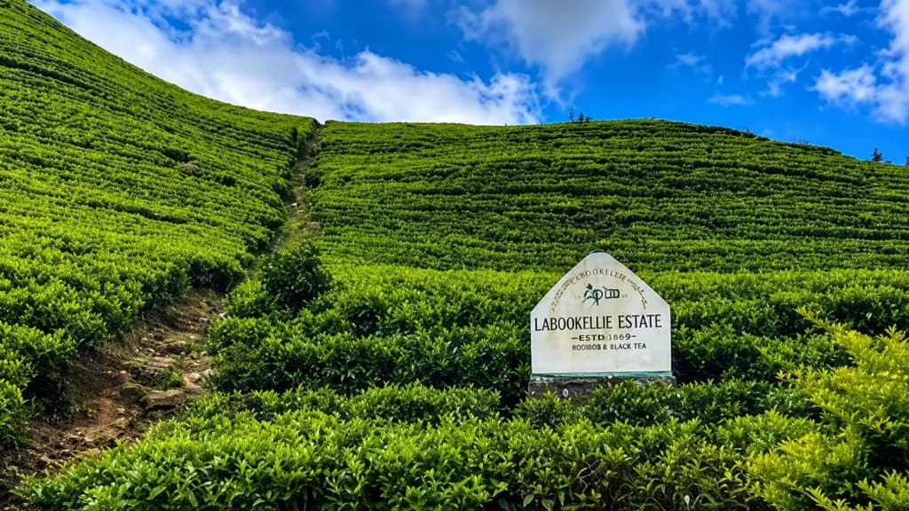
Continuing uphill from Weddemulle brings the traveller towards Labookellie Estate, one of the best-known names in Sri Lanka’s tea country.
The historical estate registry records Labookellie, formerly also written Labookelle, as an estate in the Ramboda district established in 1870.
Its position in the highlands proved ideal for the production of high-grown tea. Labookellie developed during the period when Ceylon’s plantation economy was shifting from coffee to tea, following the disease that devastated many coffee estates during the nineteenth century.
Historical accounts describe the estate’s teas as light, brisk and floral, characteristics commonly associated with cultivation at higher elevations. The estate also contains old sections associated with some of the earliest experiments in commercial tea planting in the region.
The name is believed to have developed from Labukele, referring to a forest or jungle where labu, a type of gourd, grew. As the estate expanded, the name became closely associated with Ceylon Tea and with the mountain road between Ramboda and Nuwara Eliya.
Today, the Labookellie Tea Centre remains a prominent stopping point on the route. Visitors can observe the surrounding tea landscape, learn about tea processing and enjoy views across the valleys through which earlier motorists once travelled.
The present centre stands at approximately 5,250 feet above sea level.
Motoring Through Old Ceylon
By the middle of the twentieth century, the motorcar had begun to transform travel across Ceylon.
Journeys that had once depended on horses, bullock carts, mail coaches or the railway could increasingly be made by private car. Nuwara Eliya became accessible to officials, planters, businesspeople and holidaymakers who wanted to escape the heat of the lowlands.
Nevertheless, travelling by car was not always comfortable.
Vehicles of the period had less powerful cooling systems, narrower tyres and simpler braking technology than modern cars. The long climb through Ramboda placed considerable strain on engines. Drivers had to select gears carefully while ascending and control their speed when descending.
Fuel stations and garages were also less frequent. Travellers often carried tools, spare tyres, water and basic mechanical supplies.
A breakdown could delay a journey for hours.
The Old EY Registration Plate
The car in the photograph appears to be a large mid-twentieth-century saloon, a style commonly imported into Ceylon during the post-war period. Its broad chrome grille, rounded body and substantial bonnet reflect an age when American and British cars were familiar sights on the island’s principal roads.
Its EY registration is particularly evocative.
The old number combinations, such as CE, CL, CN, EY and EN, were created from letters associated with “Ceylon.” They were gradually replaced after the introduction of the “Sri” system during the 1950s.
This small detail helps place the photograph within a particular era.
It reminds us that vehicles themselves can become historical evidence. A number plate, a bonnet shape, a wheel, a headlamp or a road surface can all help date a scene and connect it to a wider period of transport history.
A Landscape Created for Tea
The mountain scenery dominates the photograph, but almost every visible slope has been shaped by human activity.
Rows of tea bushes follow the contours of the land, creating the patterned appearance now associated with Sri Lanka’s Central Highlands. Estate roads cut across the slopes, linking different divisions with factories and the main highway.
During the nineteenth and twentieth centuries, these roads became essential infrastructure. Tea had to be collected from fields, transported to factories and then carried out of the mountains. Supplies, machinery, mail and passengers travelled in the opposite direction.
The road through Ramboda therefore served several overlapping worlds.
It was a plantation transport route, a public highway and a scenic approach to Nuwara Eliya.
For estate communities, it connected workplaces and settlements. For travellers, it offered one of the most spectacular drives in Ceylon. For photographers, every bend revealed another composition of tea, mist, waterfalls and mountains.
Ramboda Pass Then and Now
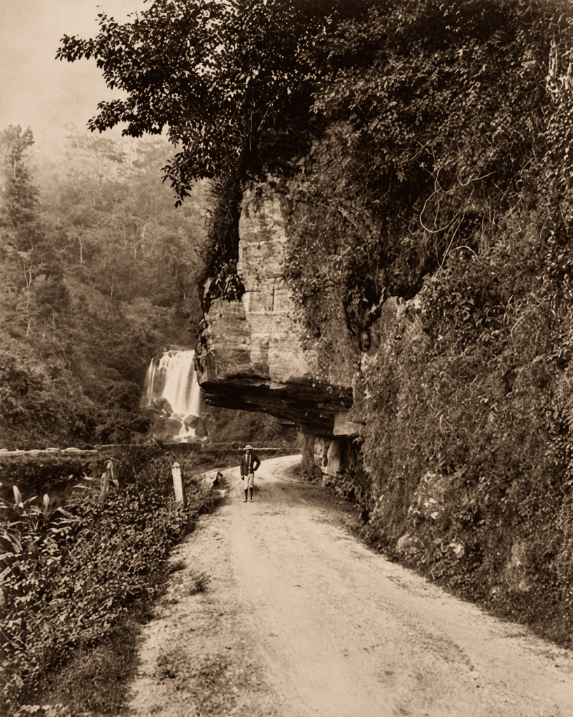
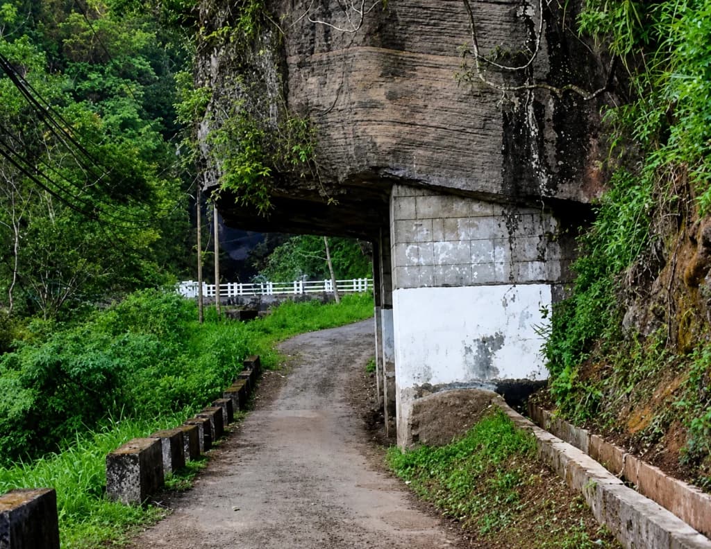
The modern traveller experiences a very different Ramboda Pass.
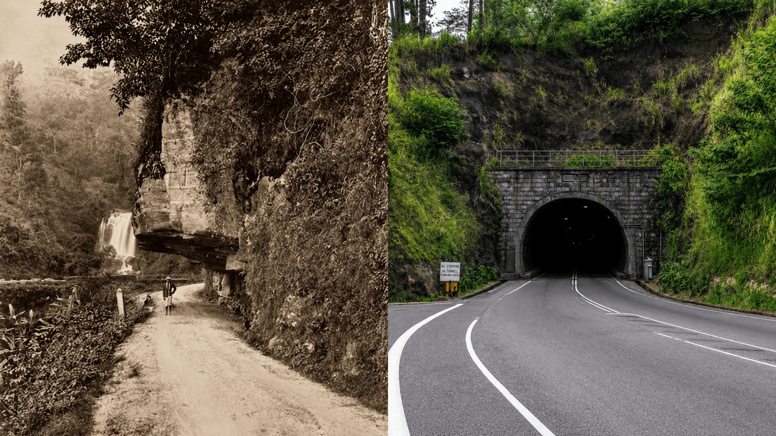
Traffic is heavier, vehicles are faster and sections of the highway have been widened or altered. One of the most significant changes was the construction of the Ramboda road tunnel at Thawalantenna, introduced to reduce congestion and improve the difficult passage along the A5 highway.
Yet much of the surrounding landscape remains recognisable.
Tea still covers the hillsides. Mist descends quickly across the mountains. Waterfalls appear beside the road after heavy rain. Between Ramboda and Nuwara Eliya, the temperature steadily falls as the highway climbs into the high country.
Travellers following the route can stop near Ramboda, observe the waterfalls, pass through the historic estate country and continue towards Labookellie before entering the outskirts of Nuwara Eliya.
The journey is best appreciated slowly. It is worth looking beyond the better-known viewpoints and tea centres to notice old retaining walls, abandoned road sections, estate entrances and surviving buildings.
These smaller details reveal how the mountain corridor developed.
Why This Photograph Matters
Historic photographs do not always record major ceremonies, famous personalities or important buildings.
Sometimes their value lies in ordinary moments.
A broken-down car, three people standing beside a mountain road and a landscape of tea may appear unremarkable. But together they preserve the atmosphere of another age: the quiet highway, the slower pace of travel and the uncertainty of crossing the highlands in an older motorcar.
The photograph also connects several chapters of Sri Lanka’s history.
It reflects:
- The development of hill-country roads
- The growth of the tea industry
- The arrival of private motoring
- The emergence of Nuwara Eliya as a destination
- The working landscape of the estates
- The importance of roadside assistance and estate communities
- The visual beauty of the Ramboda–Labookellie route
Modern travellers may pass the same place without recognising it. The road is busier and the vehicles have changed, but the great green slopes remain.
Retracing the Journey Today
For heritage travellers, the route represented in the photograph can be explored as part of a journey from Kandy or Gampola to Nuwara Eliya.
After leaving Gampola, the road passes through Pussellawa and Tawalantenna before reaching the dramatic terrain around Ramboda. From there, it begins the higher climb through tea estates towards Labookellie and Nuwara Eliya.
Useful stops along the wider route include:
- Ramboda’s mountain viewpoints and waterfalls
- Historic tea estates around Weddemulle and Labookellie
- The Labookellie Tea Centre
- Old estate roads and plantation settlements visible from the highway
- Colonial-era buildings and gardens in Nuwara Eliya
Visitors should avoid stopping on blind bends or narrow sections of the highway. Safe lay-bys and recognised viewpoints provide better places from which to observe and photograph the landscape.
Special Things to Notice on the Ramboda Road
Travellers following this route should look carefully at the small details.
The Tea Slopes
The planted rows show how the hills were reshaped for plantation agriculture.
The Estate Entrances
Old estate gates and signboards mark the boundaries of historic properties.
The Road Curves
The bends reveal the difficulty of building and driving through mountain terrain.
The Mist and Weather
The changing climate is part of the Ramboda experience, just as it was for early motorists.
The Old Retaining Walls
Stone and concrete walls along the road show the engineering needed to hold the route in place.
The View Towards Labookellie
The higher climb reveals the atmosphere of high-grown Ceylon tea country.
Final Thoughts: Motoring Through the Tea Country of Old Ceylon
The photograph of a broken-down car on the Nuwara Eliya–Ramboda road is more than a travel mishap.
It is a small window into the motoring age of Old Ceylon.
It shows a time when journeys through the hill country were slower, more uncertain and deeply connected to the landscape. It captures the challenge of mountain roads, the beauty of tea country, the importance of estate communities and the charm of early motor travel.
For a brief moment, the image allows us to stand beside the old EY-registered car, somewhere above Ramboda, with Weddemulle behind us and Labookellie waiting farther up the road.
The bonnet is open. The mountains are dark with cloud. The tea slopes rise behind the travellers.
And the journey to Nuwara Eliya continues.
Visit Us: https://trippingsrilanka.com/stories
Heritage places mentioned

Ramboda,Sri lanka
More from Old Ceylon
Colombo Public Library at 100: The Names That Still Remain
The Toll Gate at the Bridge: When Travelling Across Ceylon Cost a Few Cents at a Time